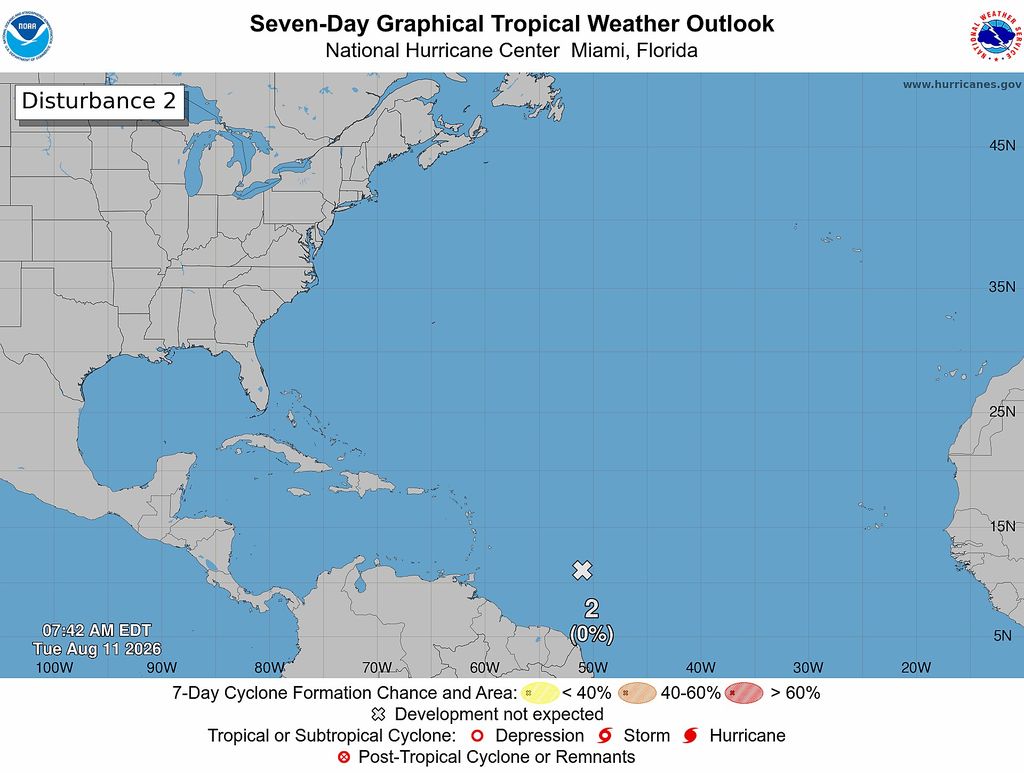

The threat of tropical cyclone development from a tropical wave approaching the Caribbean has diminished, but forecasters are turning their attention to another system farther east in the Atlantic that could encounter more favourable conditions for development.
The Trinidad and Tobago Meteorological Service (TTMS) said Tuesday that the first tropical wave, now approximately 1,300 kilometres east of the Windward Islands, is no longer expected to become better organised.
Its chance of developing into a tropical cyclone over the next seven days has fallen to zero per cent.
According to the TTMS, moderate concentrations of Saharan dust surrounding the system are suppressing the development of the strong, organised thunderstorms needed for tropical cyclone formation.
Despite the reduced development potential, the wave will continue moving westward toward the region and the Met Service said it will monitor its possible influence on local weather conditions.
There are currently no tropical storm or hurricane watches or warnings in effect for Trinidad and Tobago.
Tropics stirring as attention shifts to second Atlantic wave
Attention is now shifting farther east, where a second tropical wave is moving westward across the central tropical Atlantic.
AccuWeather forecasts suggest that the system is expected to encounter a more favourable environment over the next two and seven days. However, its prospects will depend heavily on its track and the atmospheric conditions it encounters as it approaches the Lesser Antilles.
Wind shear remains one of the important limiting factors.
Stronger shear closer to the Caribbean could disrupt thunderstorms around the disturbance and make it difficult for a well-defined circulation to develop. A track farther north, however, could allow the system to avoid some of the more hostile conditions and maintain better organisation over warm Atlantic waters.
The interaction between the two waves could also become important.
As the leading wave moves westward, it could help displace some of the dry, dusty air across the Main Development Region, potentially leaving a somewhat more favourable environment behind it for the trailing disturbance.
A temporary reduction in wind shear could provide another window for the second wave to become better organised.
Both systems are travelling through the Atlantic's Main Development Region, the belt of tropical waters between Africa and the Caribbean where many of the basin's tropical storms and hurricanes develop.
For the wider Lesser Antilles, the eventual track of the second disturbance will therefore be important over the coming days.
For now, however, it remains a developing situation rather than an immediate threat to the region.
The Atlantic has produced two named storms so far during the 2026 hurricane season: Arthur and Bertha. Should another system strengthen into a tropical storm, the next name on this year's Atlantic list is Cristobal.
Related News
Garbage piles up in Valencia; contractor stops collection requesting more money

Bharath, Ragoonath warn Hadeed-Sabga issue fuelling division

Stakeholder urges asset maintenance for Tobago security unit