
Seigonie Mohammed
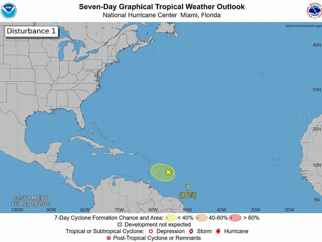
The tropical wave we’ve been tracking across the Atlantic is now just 550 km east of the Windward Islands, and its chances of developing have fallen sharply.
As of 2 pm Friday, the Trinidad and Tobago Meteorological Service (TTMS) says the system has only a 10% chance of becoming a tropical depression before reaching the Windwards, as it moves into increasingly unfavourable atmospheric conditions.
That’s down from 80% on Wednesday and 60% on Thursday.
But here’s the important distinction: a system does not need to become a tropical depression or storm to produce impactful weather.
The wave is still forecast to move across the Windward Islands from Friday night into Saturday, bringing the potential for heavy rainfall and gusty winds. The most significant weather is expected to favour Barbados and the Northern Windward Islands.
And here at home, conditions are also expected to deteriorate.
A Yellow-Level Adverse Weather Alert will take effect for Trinidad and Tobago and surrounding waters from midnight tonight through 5 pm Saturday.
The passage of the tropical wave could trigger isolated heavy showers and thunderstorms. While widespread heavy rainfall is not expected, some areas could experience intense downpours and strong wind gusts.
Possible impacts include wind gusts near 50 km/h in the vicinity of heavy showers and thunderstorms, which could topple trees and displace loose outdoor objects. Intense downpours may also lead to street or flash flooding and localised ponding, while gusty conditions could result in choppy seas.